![]()
Recently, I’ve been playing with the EasyVFR flight planning and navigation app. It’s an ultra-fast modern EFB that is free and has a truckload of features.
-
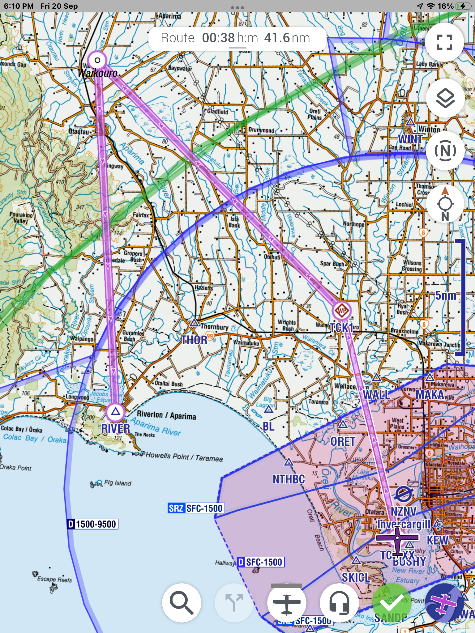
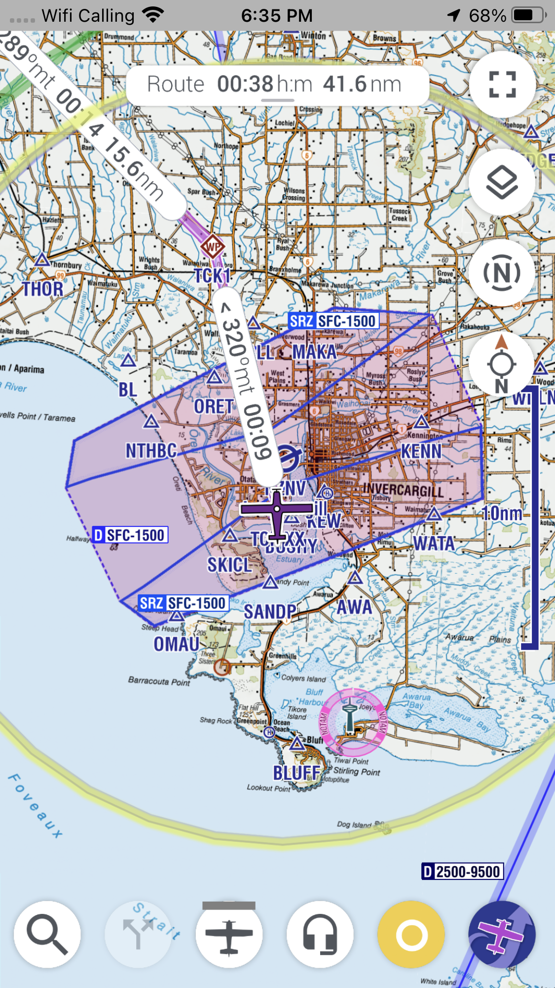
- See real-time traffic on the easy-to-read moving map
- Instant access to current Notams and relevant Weather, plus Airfield data and Airspace info
- Flight planning on the go
I’m using it on an iPad Mini mounted in my cockpit, with a back-up running on my iPhone 8+ (the app also works on Android mobile phones and tablets, so no-one will miss out).
I can even run EasyVFR on my desktop PC, which is nice for doing flight planning, checking Notams and making a route – then I can send the route to my devices ready for flying.
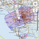
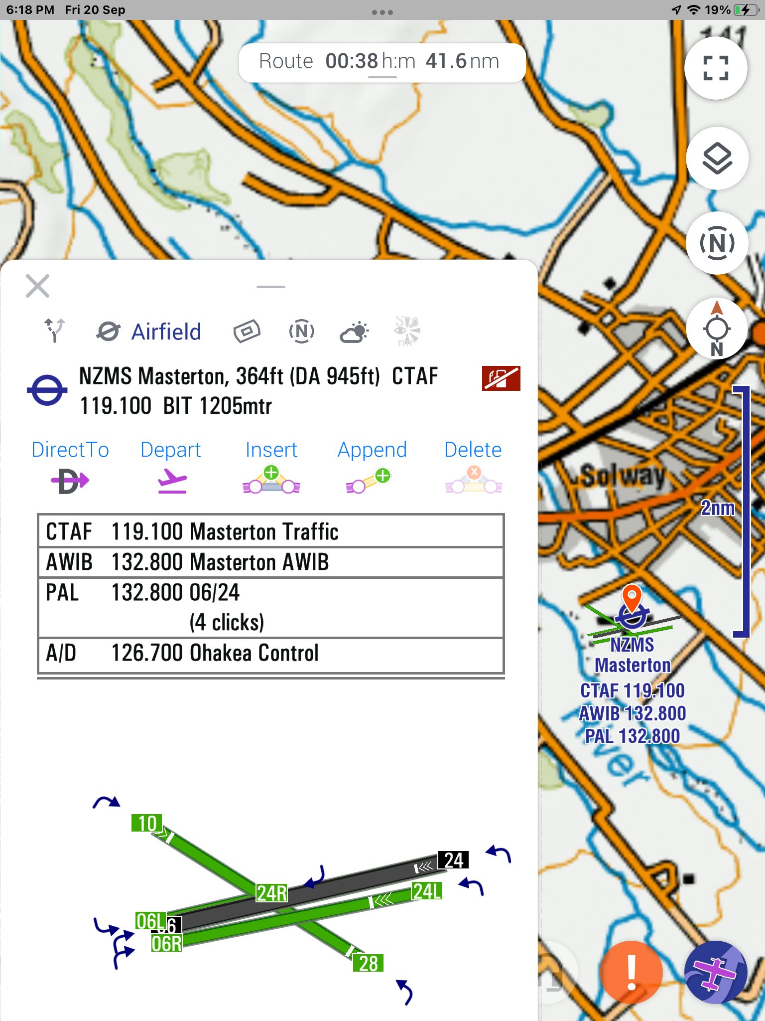
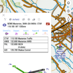
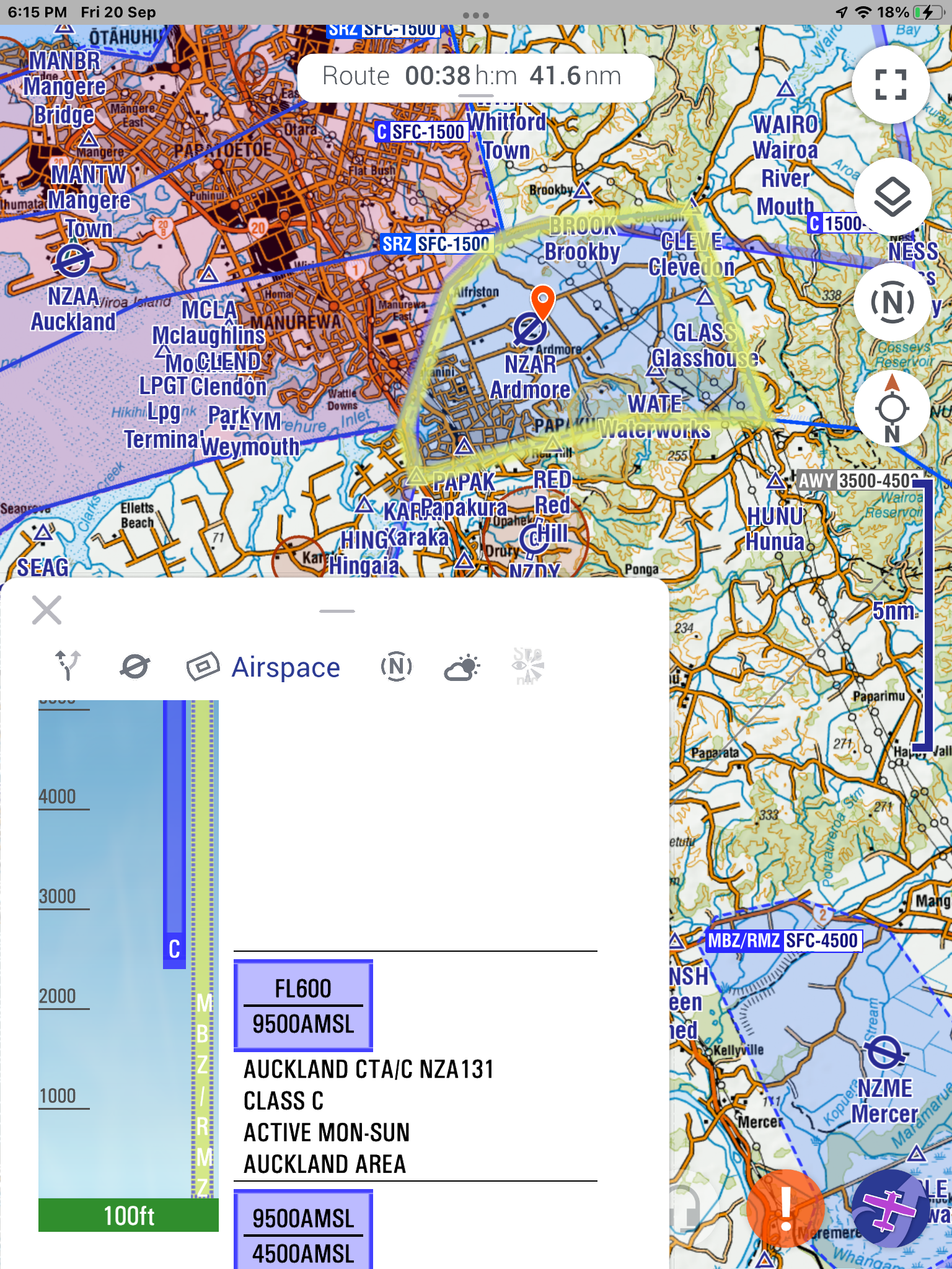
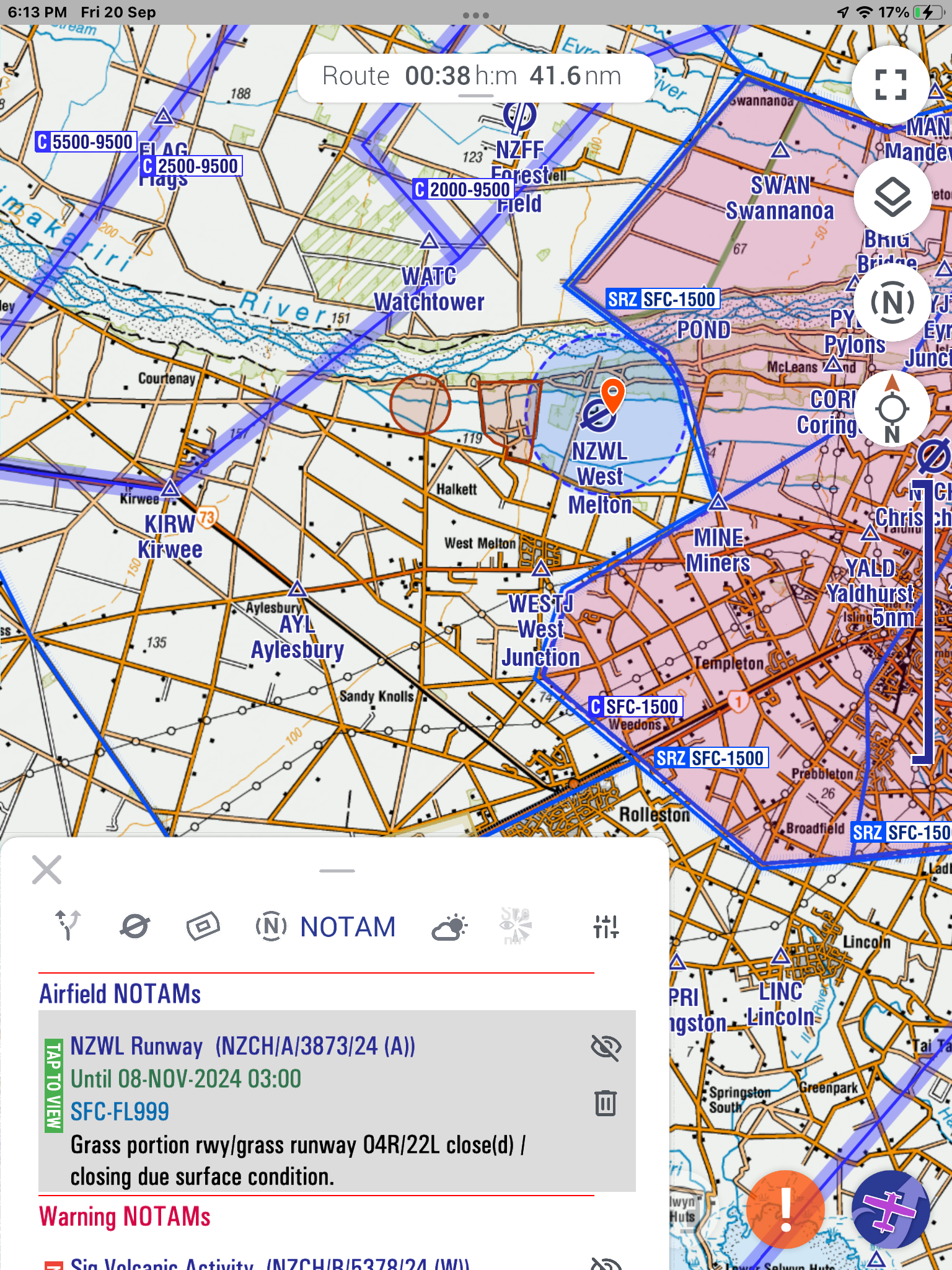
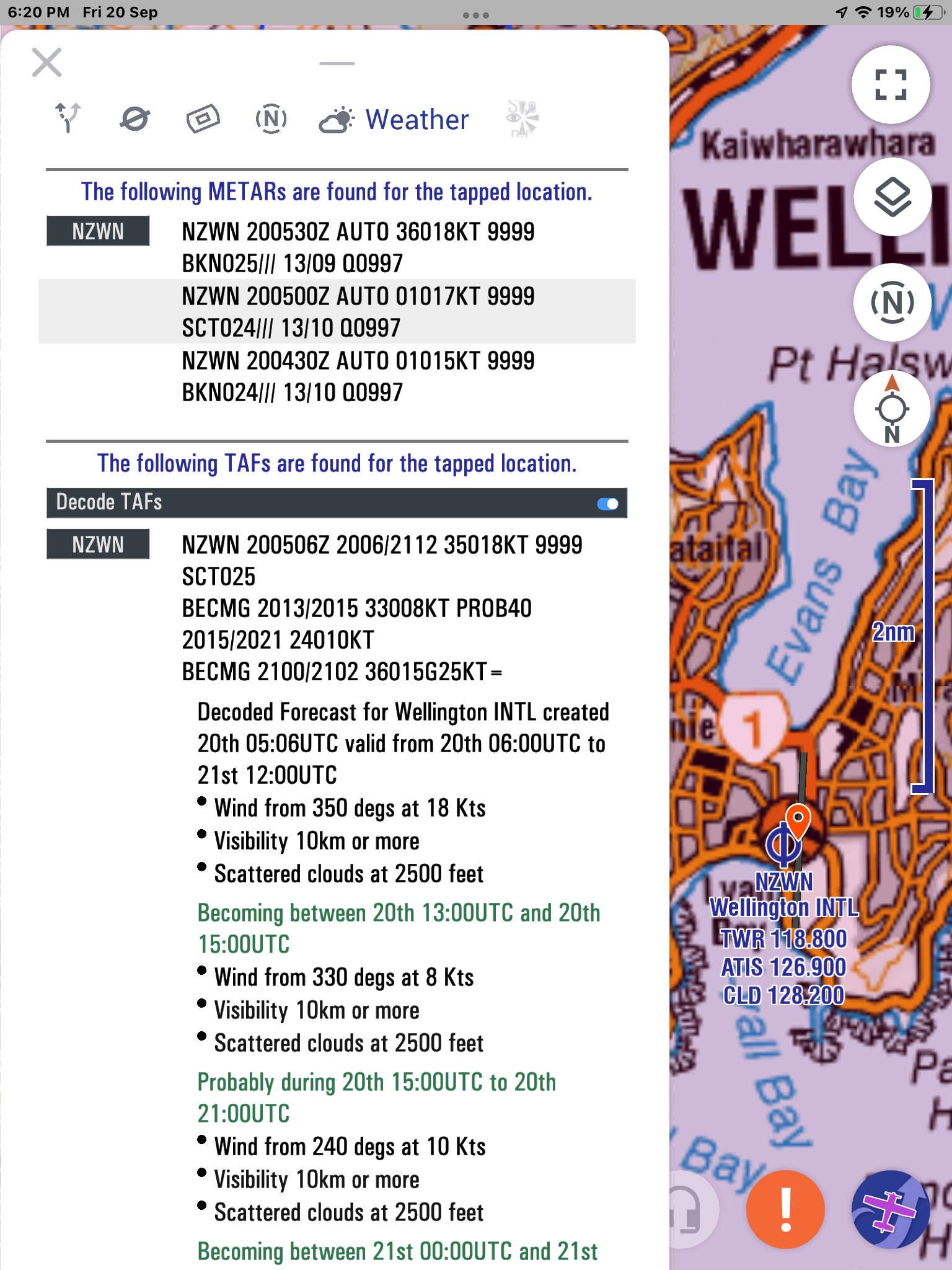
When you’re flying, you can select a location by tapping on the screen, and get quick access to airfield data, airspace info, real-time Notams and relevant weather.
The app is highly-customisable. You can set your preferences for departure, cruise and arrival zoom levels, font-size, map features. units, warnings, etc, etc. The vertical profile view, instruments and fuel availability can be switched on or off. You can display different maps and airspace info, enter your aircraft performance/fuel burn, and much more.
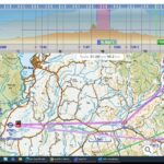
I’ve found that the developers are very friendly and respond positively to feedback. At my request, they helpfully created a 1:250k Topo map (using the LINZ dataset), to improve readability for route planning and cross-country navigation for New Zealand pilots. Big ups to them. NZ Topo250 map for EasyVFR
If you need more professional features, then you can easily upgrade to the Pro version.
EasyVFR is definitely worthwhile. Why not give it a try.